


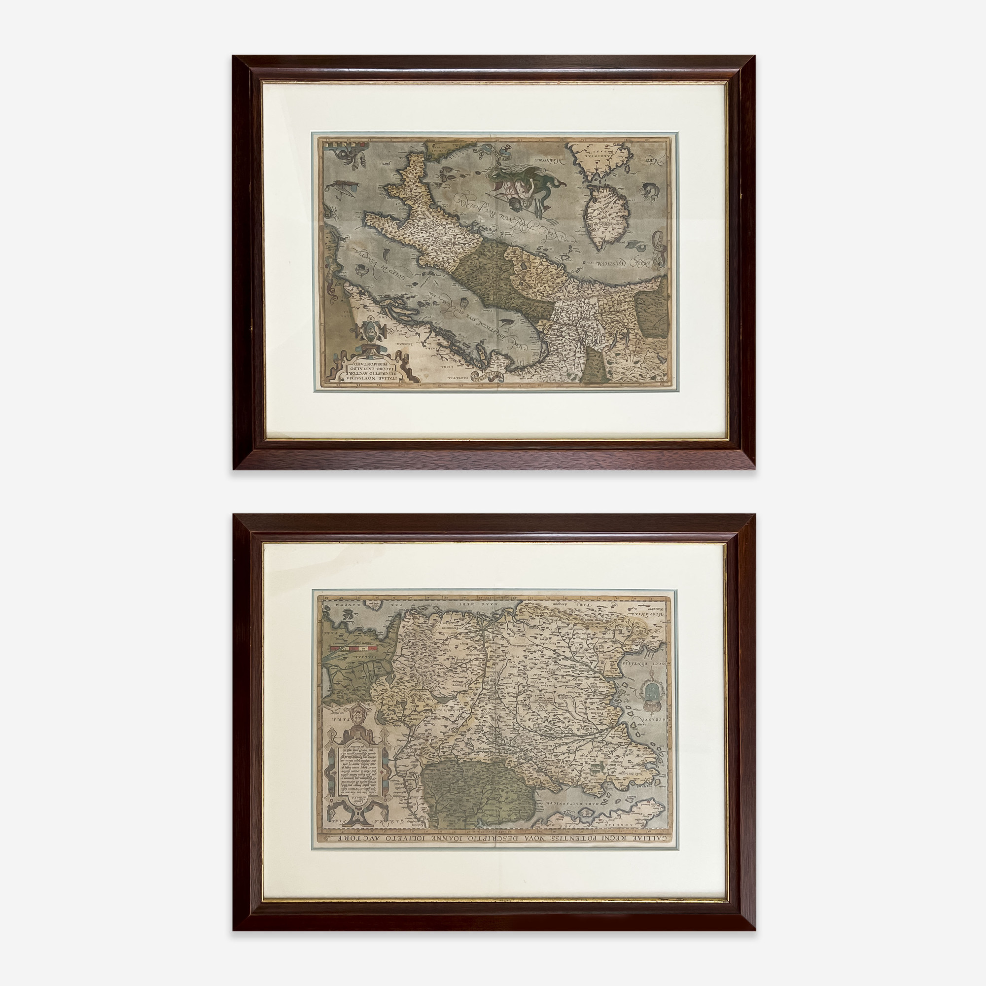


Estimate: $500 - $800
Price Realized: $344 Includes buyer's premium
If you are interested in bidding, please contact us to request more photos, or make an appointment for in-person inspection. To ensure prompt assistance, we recommend reaching out at least 24 hours before the auction by calling 212-353-2277 or emailing us at admin@capsuleauctions.com.
Condition reports are based on visual inspection by the Capsule team under typical office lighting. Unless otherwise noted, items are not examined under UV light in advance of sale. We do not guarantee the content of written or verbal condition reports. Remember, all lots are previously owned and all sales are final. The absence of a condition report does not imply that there are no condition issues with the lot.
Art has not been examined out of the frame unless otherwise stated. Frames, lampshades, or items described as “supplementary” are not considered integral to the value of the lot and are excluded from condition assessments. This includes any mat, mounting, glazing, hanging apparatus, case, box, or stand. Timepiece movements, lighting elements and items with mechanical or electrical components have not been thoroughly tested and are not covered under warranty by Capsule.